
Over the recent years, the rainy season has not been perceived with the joy and expectations that it once carried. On the flip side, whenever it rains most Kenyans are now more fearful than ever. Fearful for their lives, their children, their businesses and their properties. Personally, I have been caught up in several flood situations and it is not a pretty scene. These days, whenever I see rain clouds when I am in town, my first instinct is to get home asap. However, some Kenyans might not be too lucky to seek safety from floods in their homes.
We have seen floods get into estates and even houses making people’s homes look like Olympic pools. If you are a renter or a person looking to buy property in Kenya, then apart from doing your legal due diligence on the property, you also need to factor in flood risk. That is why I have prepared this guide for you, in it I will discuss some of the technical and non-technical ways of assessing flood risk so that you are able to tell a bad property from a good one.
Practical checks to make
1. Check the topography of the area
The first step that I take when assessing whether an area is prone to flooding is doing a topographical survey. Topography simply means how the land slopes or flattens. The several types of topography include;
- Mountainous terrains – which is characterized by steep slopes, rugged terrain and sudden changes in elevation (meaning some areas are too high and others too low). While flooding is uncommon n mountain terrains, the speed of run-off during heavy rains can easily cause damage to property or in worst cases, claim lives.
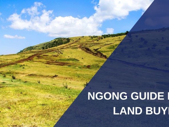
- Rolling terrain – this is where the land is gently sloping without a drastic change in elevation between the highest and lowest area. This is the best terrain because, water will naturally drain towards the lower area and chances of flooding are very little.
- Flat terrain – the land here has little to no change in terrain, it is level. Such an area presents very high flood risk because water doesn’t move when it rains and without good drainage systems, you are at the mercy of how quickly your soil can absorb the run-off.
For you to check the topography of an area, you could either use your eyes to assess it physically or use technology tools like google earth which allow you to pick up even the slightest changes in topography.
2. Distance from water sources
The next piece of information you need to establish is how close the property is from a water way. This includes rivers, dams and storm-water drains. In many cases, whenever it rains heavily, the capacity of these water pathways gets surpassed and they will often overflow. That is why the government in its wisdom, set a 30-meter riparian buffer on both sides of rivers, just in case it floods. When buying your property, just make sure it is at a safe distance from the nearby water channels, otherwise you risk experiencing floods in your property.
3. What is the soil Type?
The next factor you need to keep in mind is the type of soil you are dealing with. Different soils have different properties that will make them either drain water easily or poorly. Sand for instance has the ability to allow water to drain quite fast, so if your property is in such a soil profile, then chances of flooding are very low. However, black cotton soil is poor in handling water and is likely to present some level of flood risk especially if the area is flat. If you have a good budget, I recommend getting an engineer to do a soil test for you, the results will also be helpful in doing your foundation so you will basically be killing 2-birds with one-stone.
| Soil Type | Drainage Characteristics | Suitability for Development |
|---|---|---|
| Sand | Drains very quickly with high water infiltration and low water retention. | Generally highly suitable, although foundations may require soil stabilization in loose or unstable areas. |
| Loamy Sand | Very good drainage with rapid infiltration and moderate water retention. | Generally suitable for residential and other developments. |
| Sandy Loam | Good drainage and infiltration while retaining some moisture. | Highly suitable for most forms of development, subject to site conditions. |
| Loam | Balanced drainage, infiltration, and water retention. | Highly suitable for development where other site conditions are favorable. |
| Silt Loam | Moderate drainage; can retain considerable water and become poorly drained when compacted. | Moderately suitable; proper site drainage may be necessary. |
| Clay Loam | Moderate to slow drainage and relatively high water retention. | Moderately suitable; requires careful foundation and drainage planning. |
| Sandy Clay Loam | Moderate drainage, better than heavy clay but slower than sandy soils. | Moderately suitable with appropriate drainage measures. |
| Sandy Clay / Silty Clay | Slow infiltration and relatively high water retention. | Requires careful drainage and geotechnical assessment before development. |
| Clay | Slow drainage and low permeability; prone to retaining water. | Less suitable without engineered drainage and appropriate foundation design. |
| Black Cotton Soil (Vertisols) | Very poor drainage when wet and prone to significant expansion and contraction. | Challenging for development; requires specialized foundation and drainage solutions. |
| Alluvial Soil | Drainage varies widely depending on the proportion of sand, silt, and clay. | Variable; requires site-specific assessment, especially near rivers and floodplains. |
| Gleysols / Poorly Drained Soils | Very poor drainage with prolonged water saturation and potentially high groundwater levels. | Generally unsuitable for development without substantial drainage and engineering intervention. |
4. Vegetation growing in the area
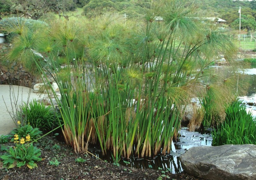
Another sign you should look at is the type of vegetation growing near or on the property. Some plants like papyrus reeds are known to exist in places with poor drainage, so seeing them automatically tells you that the area has a high flood risk. I recommend doing a 30-meter radius check for vegetation to see what plants you are dealing with.
5. Check old buildings
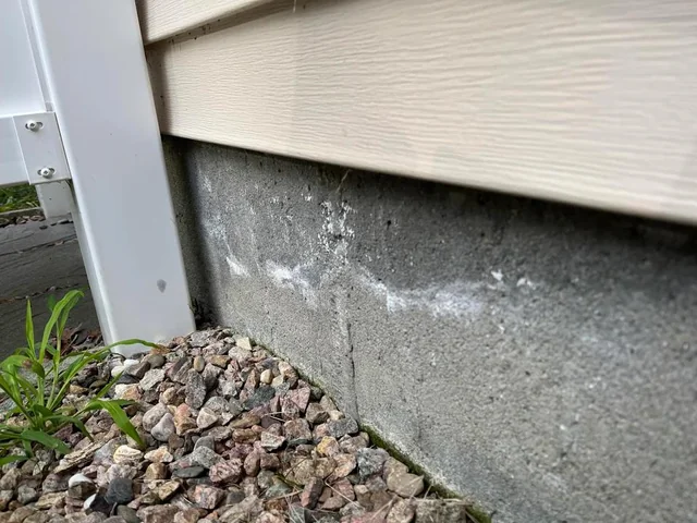
The next surest way of establishing a flood prone area is checking nearby older buildings for water stains on the lower walls. Such marks often cause the part near the foundation to discolor or have a darker appearance to it. In doing my checks, I also look out for raised barriers near doorways. If you notice that your neighbors have raised stones near their gates or sacks filled with soil, then there is a good possibility that the place often floods. It is prudent that you ask some of the neighbors about the situation to get a clear answer.
6. Historical Evidence
Historical evidence from the area will also help you in establishing if the area floods. You can google for articles and news pieces on the area to check on this. For example, entering a query like ‘Ruai floods’ on google will bring you all the past flood news on the place and you can get a glimpse of how frequent the place experiences flooding. For renters, if the property you want to move to has previously been affected by floods, then history has a way of repeating itself and you might find yourself in a similar situation.
7. Visit the land during rains
The surest way to know without a doubt if a place floods, is to visit the area during the rainy season. You will be able to see first-hand how the location interacts with rains and if you are comfortable with it. For instance, unpassable roads during rains might be a bad sign if you are a buyer. You should also look out for stagnated water near the property which might mean that the soil drains poorly.